


100 – ML2024 – METAPOLIS ARCHITECTS (BE-RO)
Main authors: Metapolis Architects (Belgia) prin filiala sa Metapolis Architects (Romania): Mircea Munteanu, Cristian Panaite
Architecture collaborators: Metapolis Architects: Diana Sava, Mihai Șom, Laura Dinu, Bogdan Stoicescu
Specialties collaborators: Studio de Peisaj Ana Horhat: Ana Horhat, Ivona Svinți, Claudia Uglea
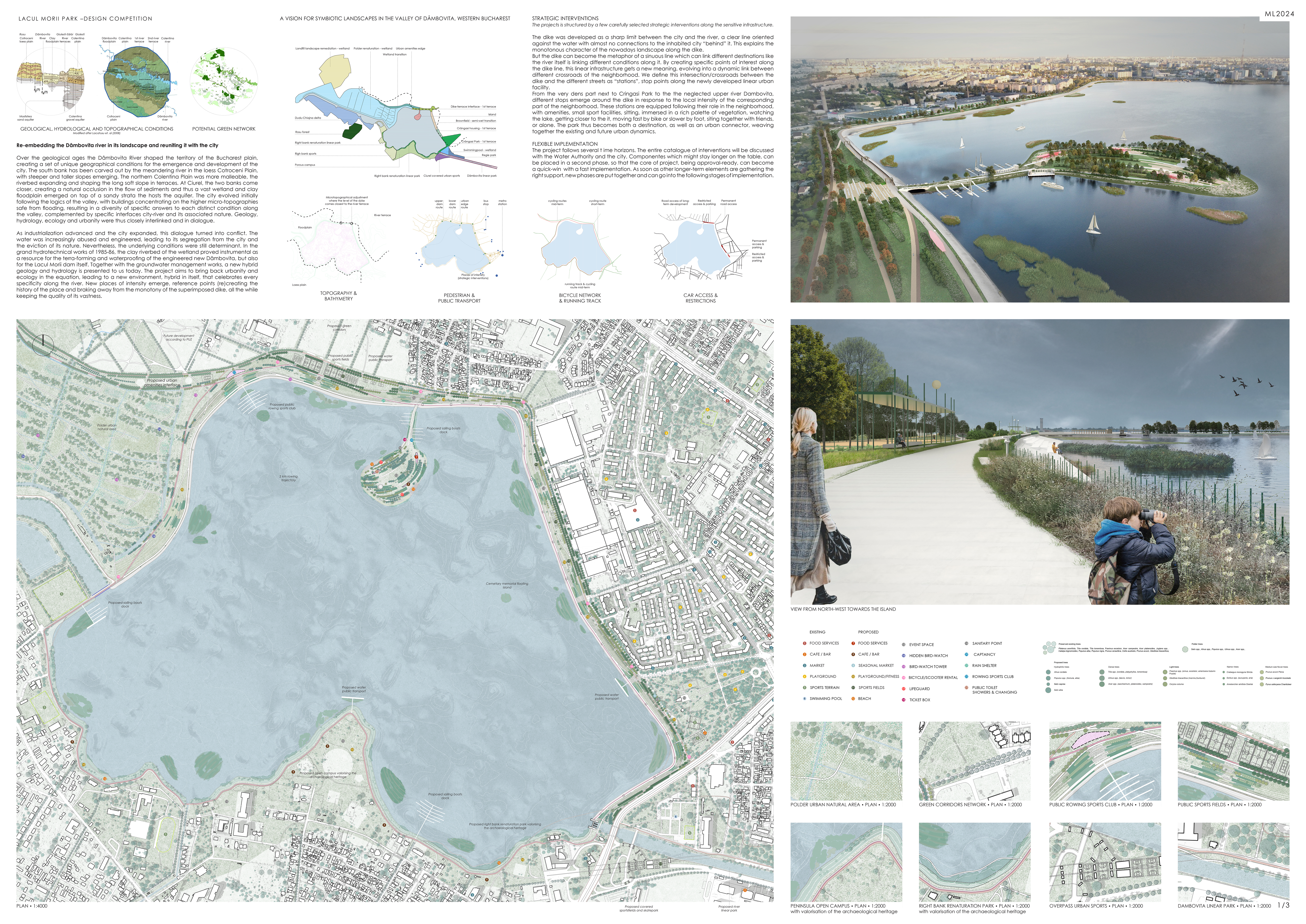
Re-embedding the Dâmbovița river in its landscape and reuniting it with the city
Over the geological ages the Dâmbovița River shaped the territory of the Bucharest plain, creating a set of unique geographical conditions for the emergence and development of the city. The south bank has been carved out by the meandering river in the loess Cotroceni Plain, with steeper and taller slopes emerging. The northern Colentina Plain was more malleable, the riverbed expanding and shaping the long soft slope in terraces. At Ciurel, the two banks come closer, creating a natural occlusion in the flow of sediments and thus a vast wetland and clay floodplain emerged on top of a sandy strata the hosts the aquifer.
The city evolved initially following the logics of the valley, with buildings concentrating on the higher micro-topographies safe from flooding, resulting in a diversity of specific answers to each distinct condition along the valley, complemented by specific interfaces city-river and its associated nature. Geology, hydrology, ecology and urbanity were thus closely interlinked and in dialogue.
As industrialization advanced and the city expanded, this dialogue turned into conflict. The water was increasingly abused and engineered, leading to its segregation from the city and the eviction of its nature. Nevertheless, the underlying conditions were still determinant. In the grand hydrotechnical works of 1985-86, the clay riverbed of the wetland proved instrumental as a resource for the terra-forming and waterproofing of the engineered new Dâmbovița, but also for the Lacul Morii dam itself. Together with the groundwater management works, a new hybrid geology and hydrology is presented to us today.
The project aims to bring back urbanity and ecology in the equation, leading to a new environment, hybrid in itself, that celebrates every specificity along the river. New places of intensity emerge, reference points (re)creating the history of the place and braking away from the monotony of the superimposed dike, all the while keeping the quality of its vastness.
STRATEGIC INTERVENTIONS
The projects is structured by a few carefully selected strategic interventions along the sensitive infrastructure.
The dike was developed as a sharp limit between the city and the river, a clear line oriented against the water with almost no connections to the inhabited city “behind” it. This explains the monotonous character of the nowadays landscape along the dike.
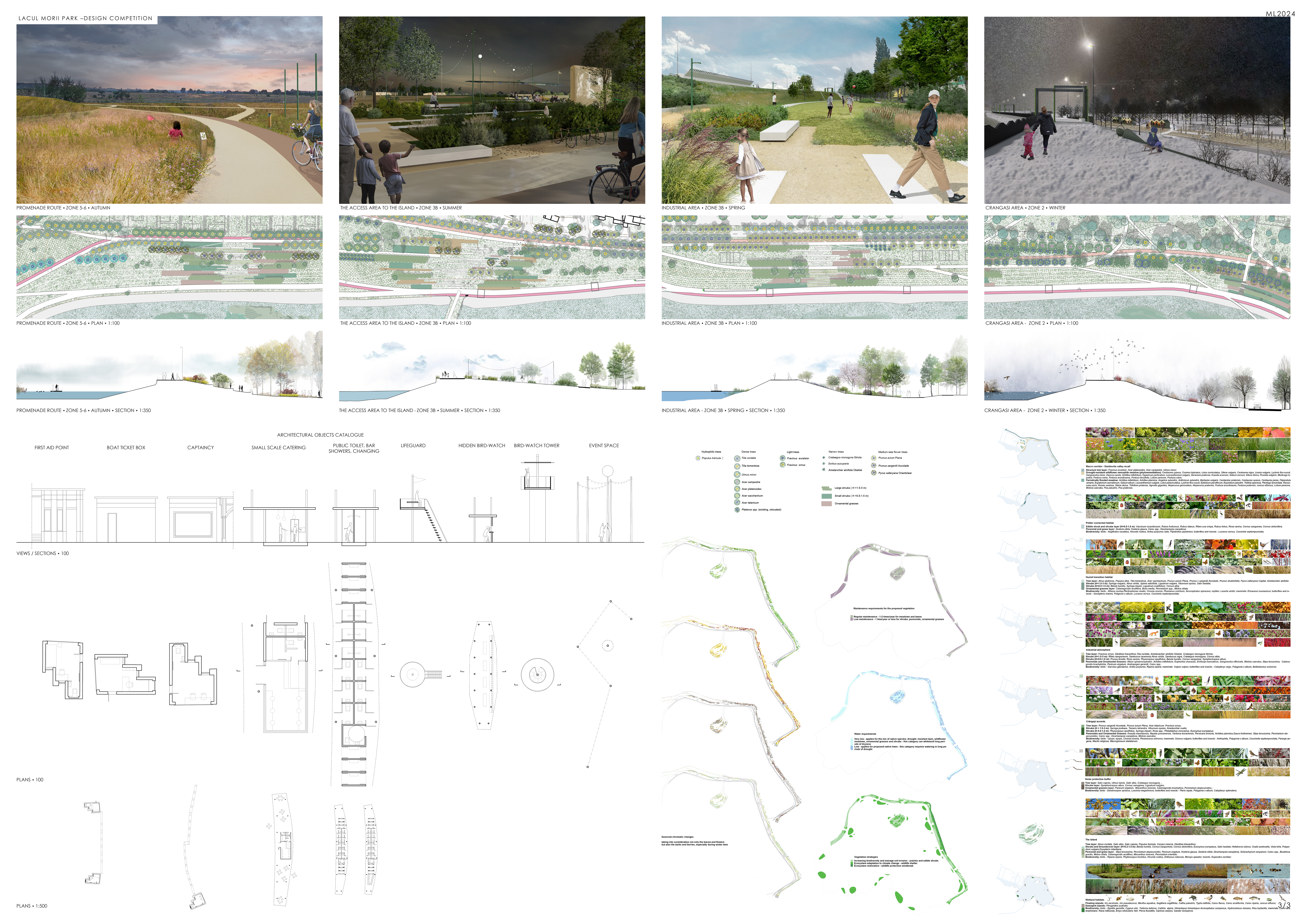
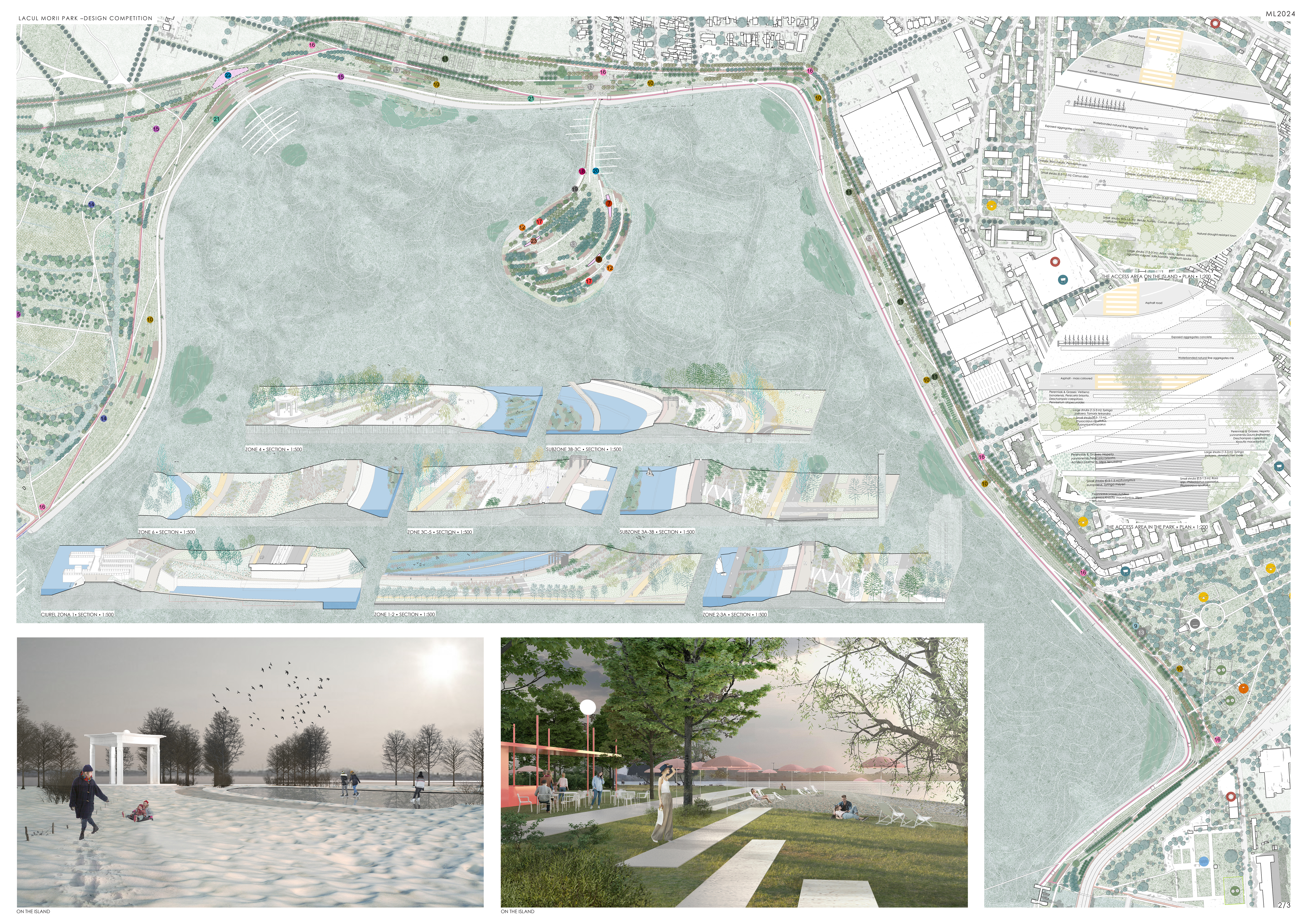
But the dike can become the metaphor of a sinuous line which can link different destinations like the river itself is linking different conditions along it. By creating specific points of interest along the dike line, this linear infrastructure gets a new meaning, evolving into a dynamic link between different crossroads of the neighborhood. We define this intersection/crossroads between the dike and the different streets as “stations”, stop points along the newly developed linear urban facility.
From the very dens part next to Crângași Park to the the neglected upper river Dâmbovița, different stops emerge around the dike in response to the local intensity of the corresponding part of the neighborhood. These stations are equipped following their role in the neighborhood, with amenities, small sport facilities, sitting, immersed in a rich palette of vegetation, watching the lake, getting closer to the it, moving fast by bike or slower by foot, siting together with friends, or alone. The park thus becomes both a destination, as well as an urban connector, weaving together the existing and future urban dynamics.
FLEXIBLE IMPLEMENTATION
The project follows several time horizons. The entire catalogue of interventions will be discussed with the Water Authority and the city. Components which might stay longer on the table, can be placed in a second phase, so that the core of project, being approval-ready, can become a quick-win with a fast implementation. As soon as other longer-term elements are gathering the right support, new phases are put together and can go into the following stages of implementation.